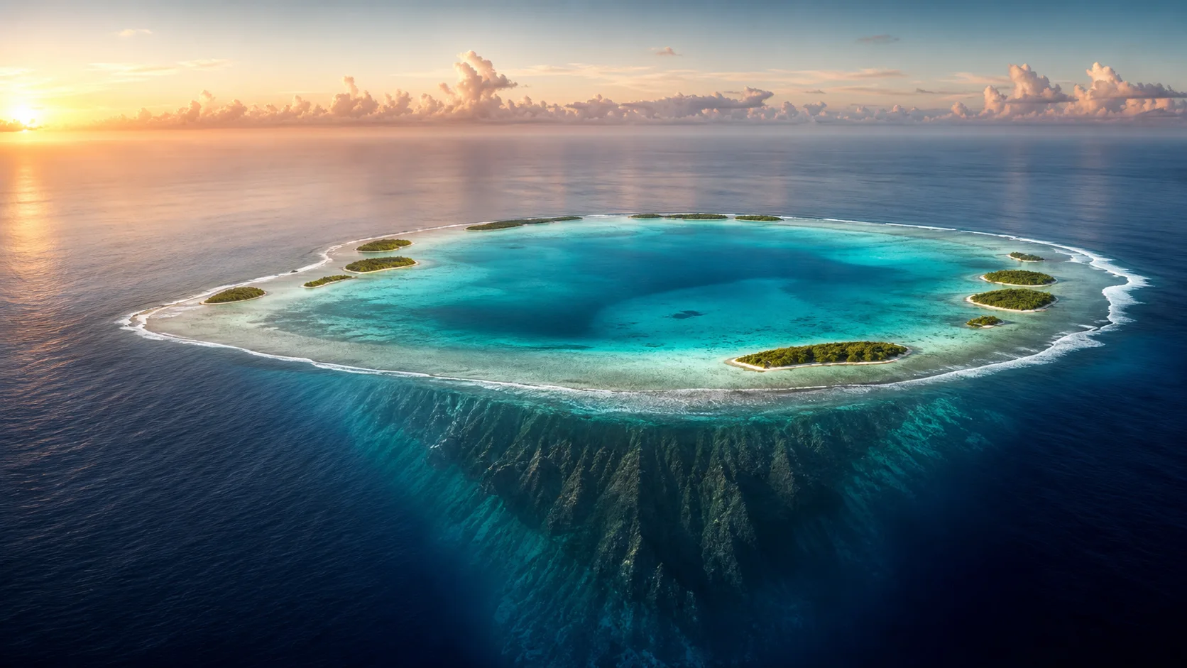
17° 00′ 18″ S / 149° 34′ 13″ W
53 km north of Tahiti
The island · Geology
A mountain vanished.Life built an island.
There was once a mountain where this lagoon lies. To understand Teti'aroa, look beneath the water.
Go beneath the surfaceFrom fire to reef
An island, three lives.
Choose a chapter to see the island change.
First, fire.
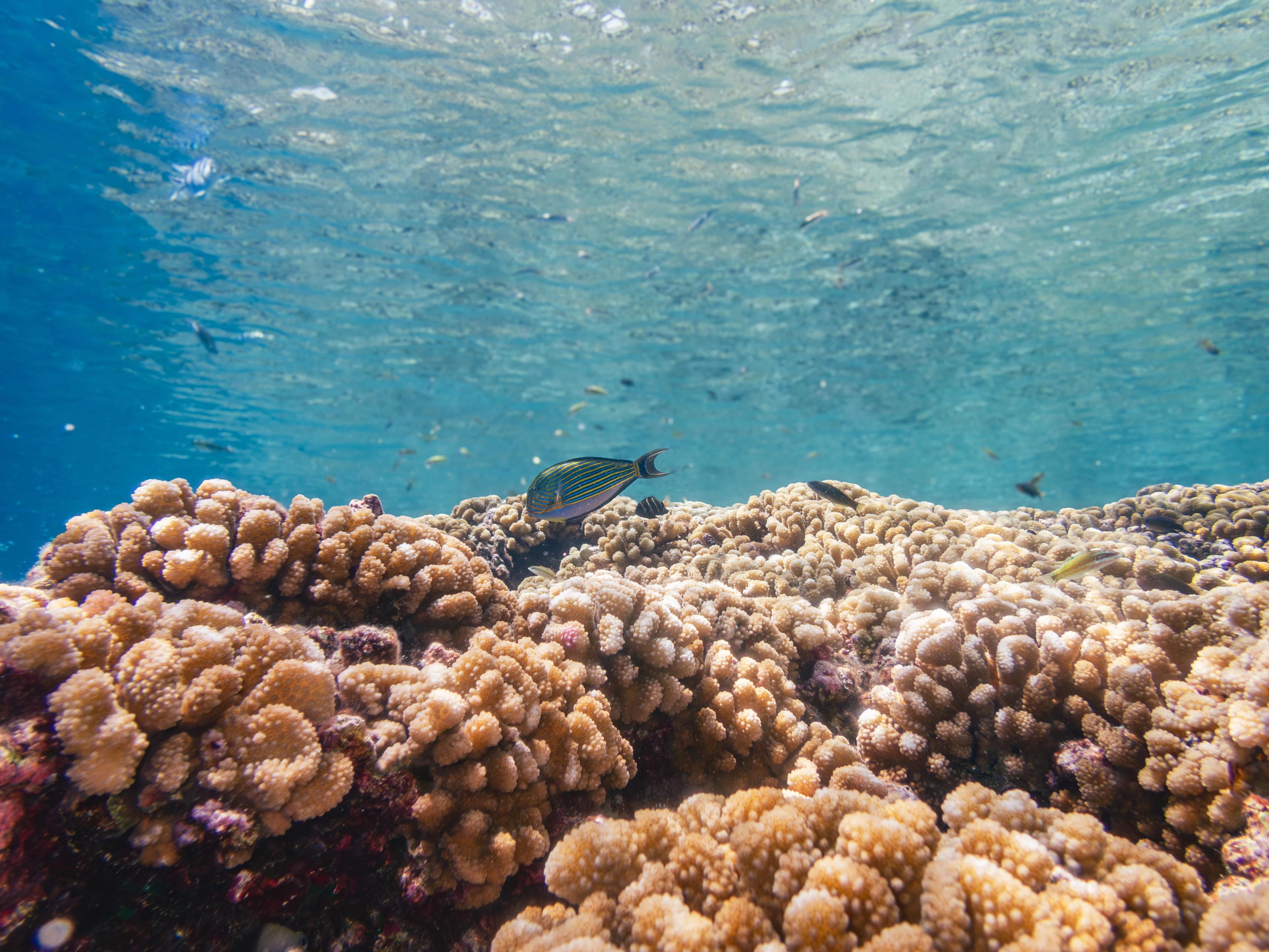
Eruption by eruption, a mountain rises from the ocean floor. Its summit breaks the surface. Reef-building corals need sunlight. They settle in the shallows along the island’s shores and grow into a fringing reef. Eventually, the Pacific Plate carries the mountain away from its magma supply. The volcano falls silent.
Look across the Society Islands
The story is written in the shoreline.
Near Mehetia, the hotspot is still building volcanoes. Follow the chain westward and the rocks grow older: mountains wear down, lagoons open, reefs remain. These neighbouring islands give us glimpses of a story that takes millions of years.
One hotspot. A moving plate.
Swipe across the map to follow the islands →
North up · Ma = millions of years · Volcanic rock ages, not reef ages. Island markers are enlarged; the hotspot area is approximate.
Age ranges and plate motion: Neall & Trewick (2008). See also Gillespie et al. (2008).
Every island here is a passenger.
The hotspot never moves. The plate above it never stops. It slides northwest at about 110 millimetres a year, slower than your hair grows, and that is enough to pull each new volcano off the fire that fed it. Start 4.5 million years back. Maupiti leaves first. Mehetia has barely pulled away.
Today
495 km of plate past the hotspot
East → west · from younger rocks to older
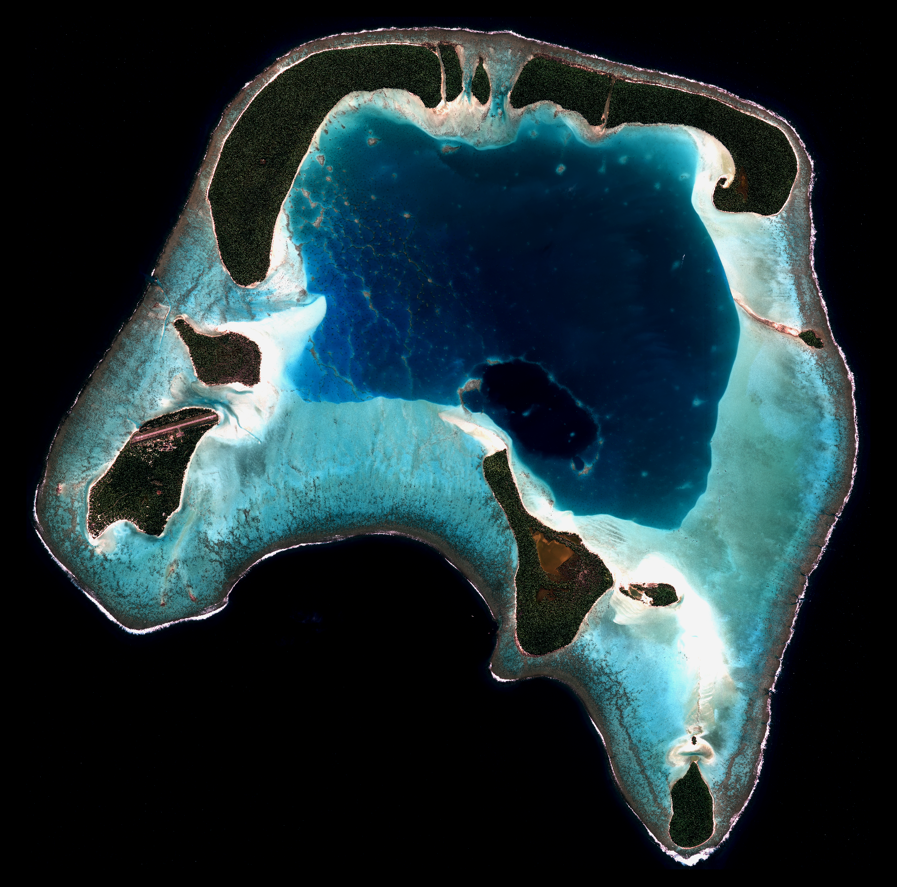
©Airbus Defense & Space – CNES, image Pléiade THR 2022
Teti'aroa · Volcano undated
The mountain is out of sight.
Teti'aroa lies near Tahiti and Moorea, yet its mountain has already vanished beneath a lagoon. Distance from the hotspot cannot tell the whole story. The weight of a neighbour may help explain what happened here.
And Teti'aroa?
So why is Teti'aroa already an atoll, so close to Tahiti?
Its submerged volcano has not been dated directly. To understand why its mountain disappeared while its neighbours still stand, look beneath the whole island chain.
02 / A shared ocean floor
One island’s weight changes its neighbours.
Tahiti’s mountains are just the part we can see. Most of its volcanic mass lies below the sea, weighing on the oceanic plate. As Tahiti grew, the plate bent downward across a region that includes Teti'aroa. Farther out, it arched upward.
01 / Tahiti
A mountain’s weight
Each eruption adds rock to the growing volcano. Beneath that enormous weight, the oceanic plate slowly bends.
02 / Teti'aroa
Drawn downward
This extra sinking may help explain why Teti'aroa is already an atoll while nearby islands still have mountains.
03 / Makatea
Reef above the sea
Makatea’s limestone stands high above the waves. Upward bending beyond the depression may help explain how an ancient reef became dry land.
A simplified model, not a geographical transect. Distances and bending are exaggerated. Regional flexure is measured; its precise contribution to Teti'aroa’s sinking and Makatea’s uplift remains uncertain.
03 / A landscape under water
The lagoon was once dry land.
During ice ages, water locked in continental ice sheets lowered the ocean. Teti'aroa’s limestone platform stood exposed. Rain worked into the rock, dissolving hollows and leaving ridges between them. The returning sea hid that landscape, but did not erase it.
- 01
The sea retreats
The reef platform emerges as the ocean falls. What looks like open water today becomes land.
- 02
Rain carves the rock
Fresh water dissolves calcium carbonate, opening cavities and leaving an uneven limestone surface.
- 03
The sea returns
Coral grows on some of the submerged high points. Just below the surface, these ridges still shape the routes boats take across the lagoon.
The control reveals a simplified, already-eroded landscape. It is not a dated sea-level record or a depth chart; dissolving this rock took thousands of years.
04 / How a motu takes shape
The ground beneath your feet came from the reef.
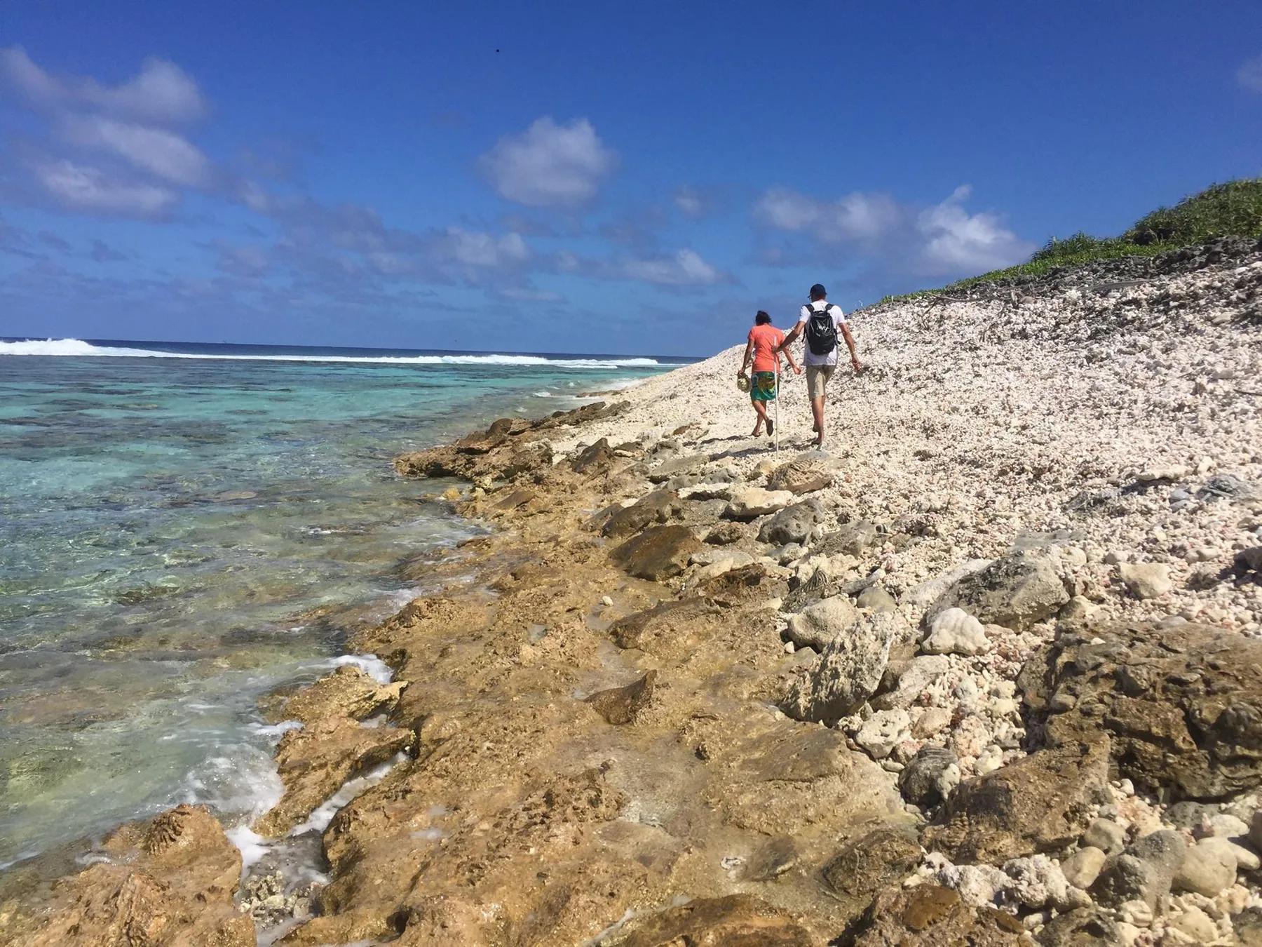
Look closely at the ground on a motu: broken coral, rock and sand, carried there by waves. The ocean moves this material, sorts it and piles it up. Deposit by deposit, the remains of marine life become an island.
01
Waves carry it
Powerful swell and cyclone waves lift broken coral, boulders and sand across the reef crest onto the reef flat.
02
The rubble settles
Deposit after deposit, a ridge rises. Some sandy motu, known as tahuna, keep shifting without a solid base. On others, large coral boulders carried by storms cement into a conglomerate platform. The base holds firm; sand and stones remain loose above. Along parts of the tidal shoreline, calcium carbonate from coral skeletons dissolves and precipitates again, cementing sloping layers of beachrock beneath the sand. Sun, tides, seabird guano and microorganisms all play a part. When storms uncover these layers, the rock armours the shore against erosion.
03
Life finds a foothold
Seabirds arrive on the new motu. Their guano fertilizes the nutrient-poor sand. Seeds, crab larvae, birds, lizards and insects find their way here by air and sea: floating, flying, swimming, hitchhiking or drifting.
04
Plants take root
Vegetation establishes on the deposits. Roots help hold the sediment in place; the food and shelter plants provide support whole webs of animal life. A motu takes shape, with beaches that waves and currents continue to rearrange.
The work does not stop when an island takes shape. Every storm, swell and shifting current can move its shores again.